|
|
|
|
|
|
|
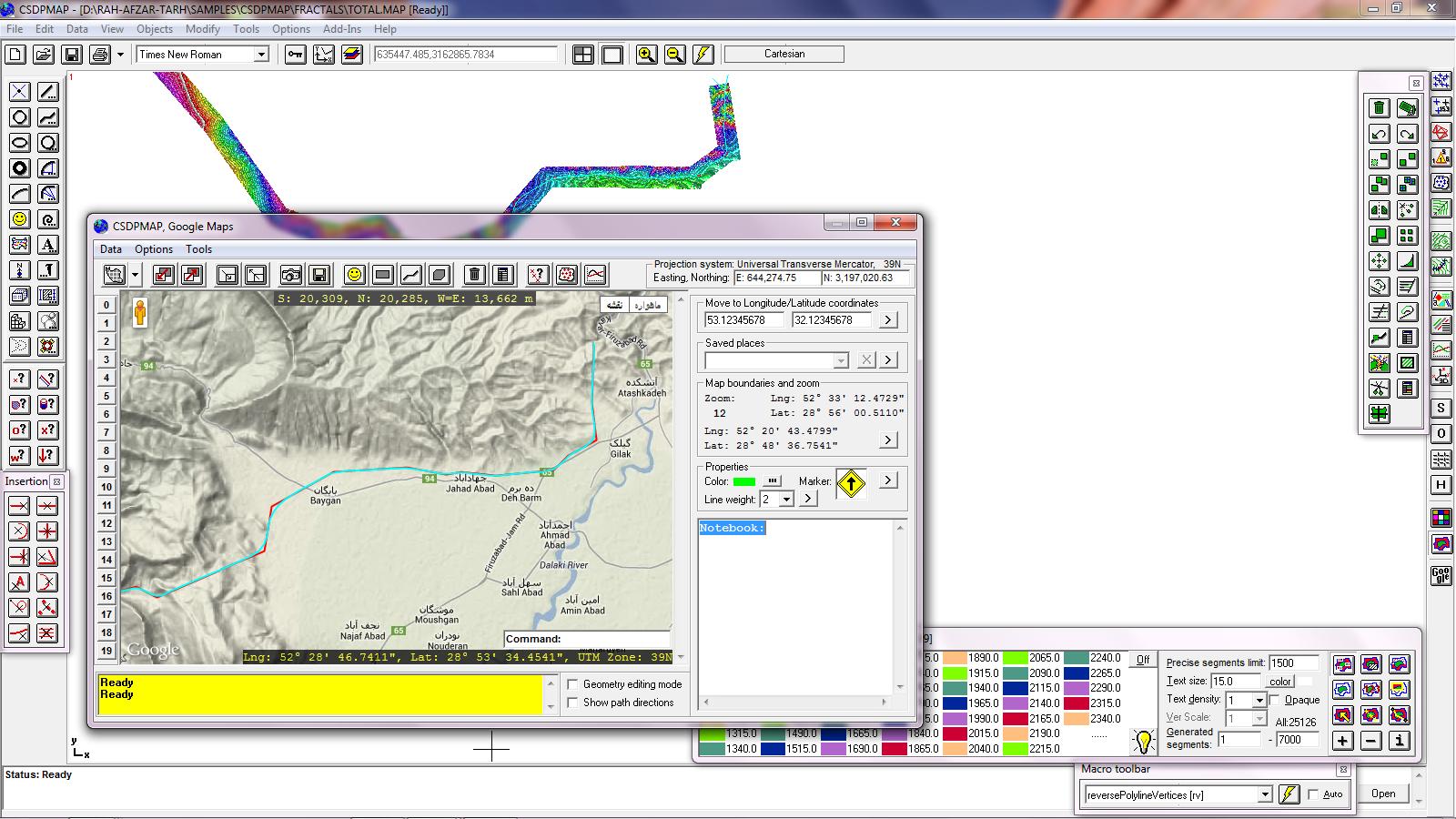
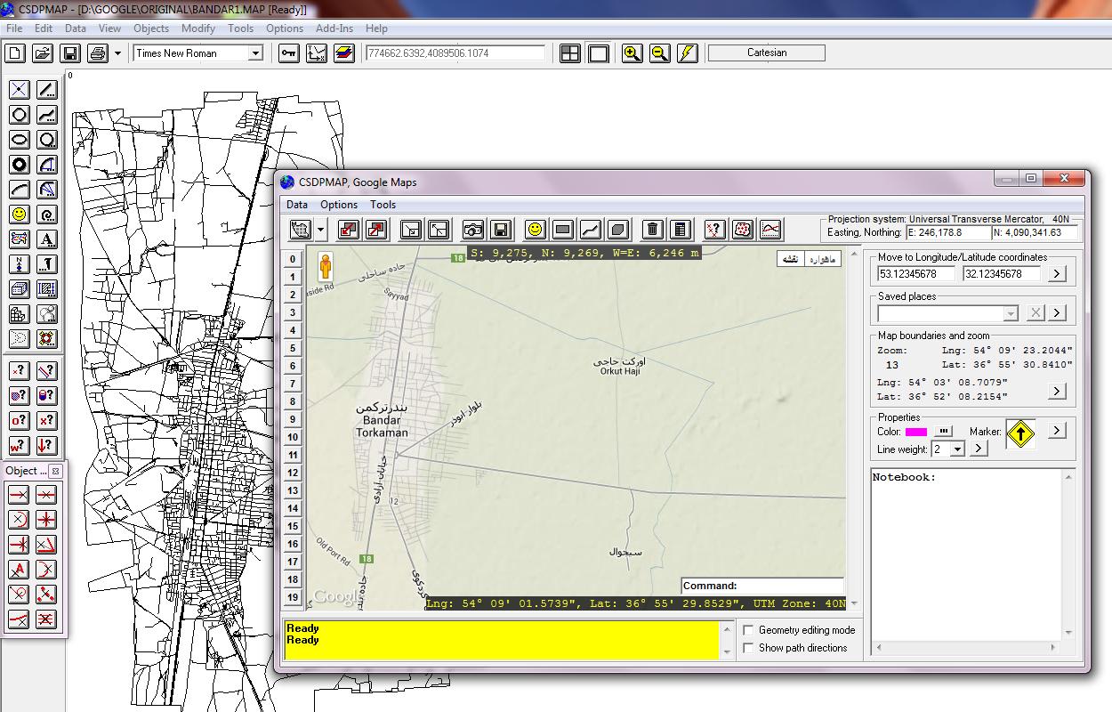
- A new environment for working with Google Maps
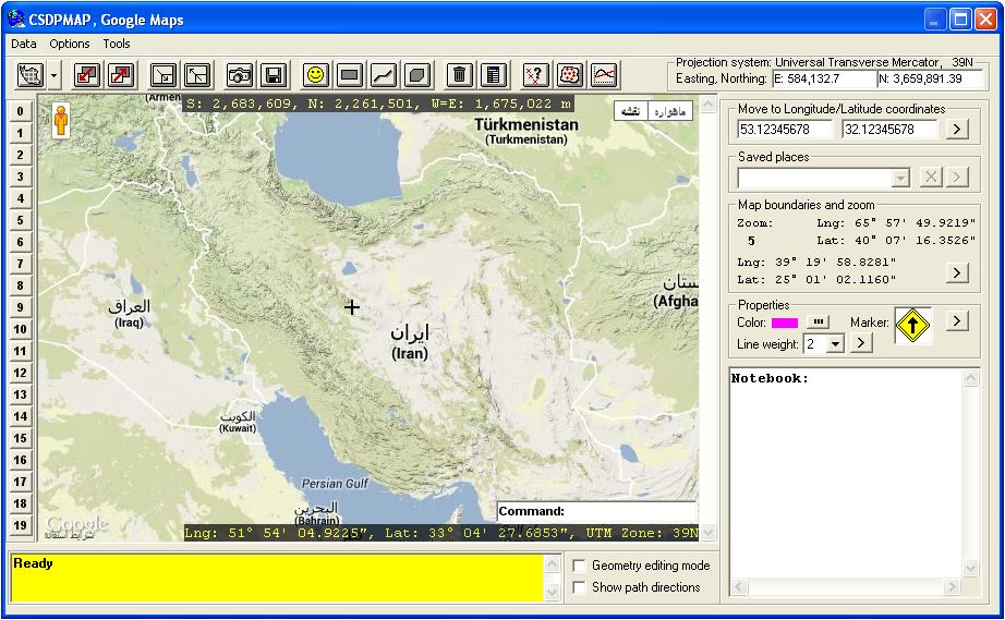
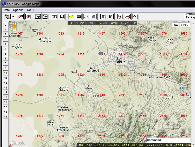
- Possibility to show Google Maps in Terrain, Satellite, Roadmap and Hybrid styles
|
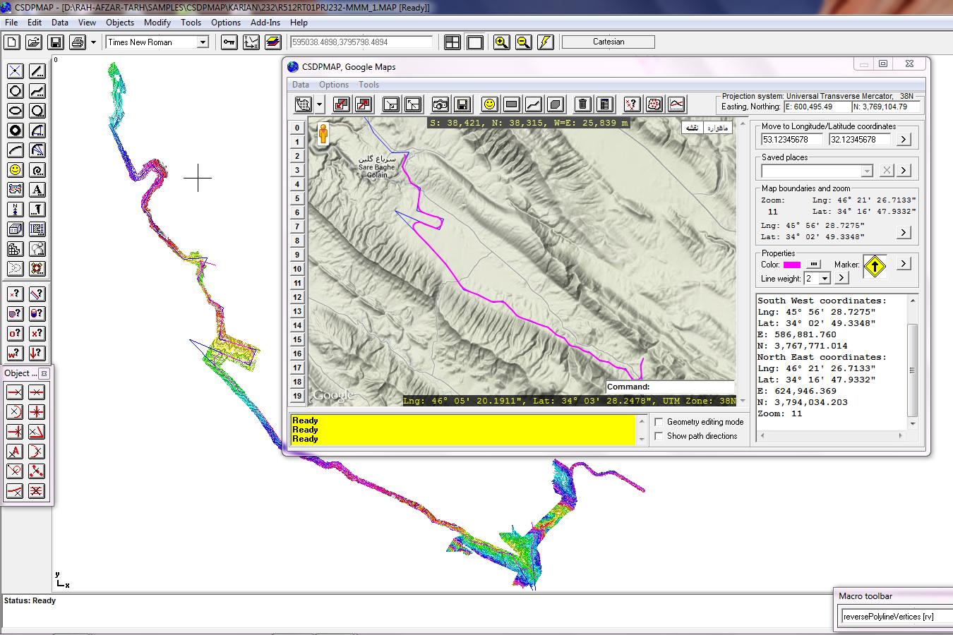
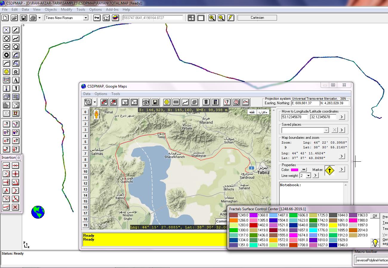
- Possibility to have a zoom window just like CSDPMAP normal environment
|
- Displaying of map boundaries (bottom-left and top-right longitude/latitude coordinates) at each zoom along with the current zoom number
|
|
|
- Displaying coordinates of position of mouse both in longitude/latitude and in Cartesian coordinates of current projection system along with UTM zone number
|
|
|
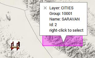
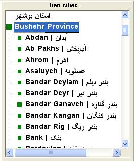
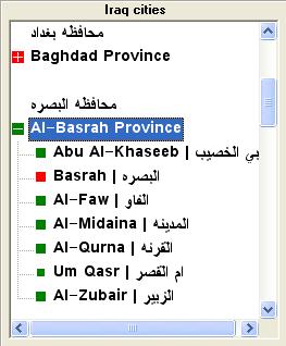
- Tools for searching and finding different provinces and cities in Iran and Iraq
|
|
|
- Possibility to find a place with longitude/latitude coordinates and also possibility to name places
|
|
| Back to Top
|
|
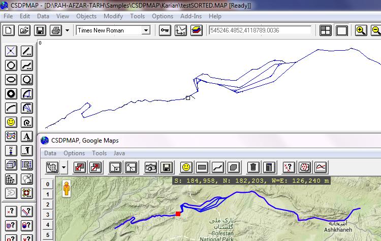
- A very useful tool named Localize to find the corresponding location in Google Maps window based on the current location in CSDPMAP normal environment and vise versa
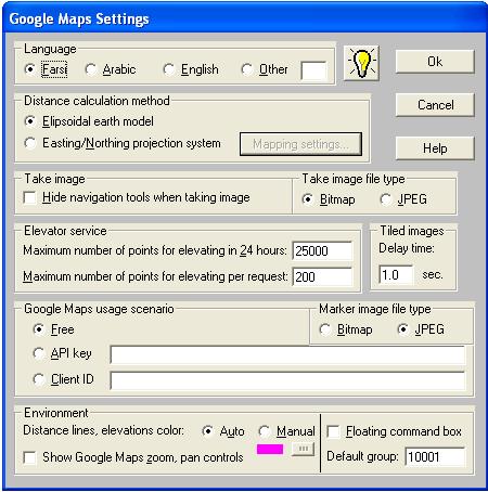
- Possibility to specify language when working with Google Maps
|
- Possibility to specify the method of calculating distances either based on earth ellipsoid or Cartesian projection system
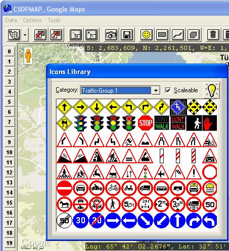
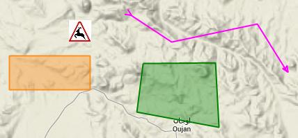
- Possibility to draw polylines, rectangles, polygons and icons
- Possibility to assign layer, group, color, weight etc. to drawn objects
|
- Possibility to find elevations of mouse position when drawing objects
- Possibility to specify longitude/latitude or easting/northing coordinates directly when drawing objects
- Possibility to assign special effects of Stream and Route when drawing polylines
- Possibility to select objects based on type, color, layer, group, etc.
|
|
|
| Back to Top
|
|
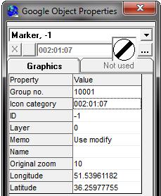
- Possibility to change graphical and geometrical properties of objects using Google Properties Wizard just like Objects Properties Wizard in CSDPMAP normal environment
- Possibility to erase drawn objects and undoing erase (Oops), and reversing polylines
- Tools to get information about drawn objects and also an ID tool to find coordinates of points
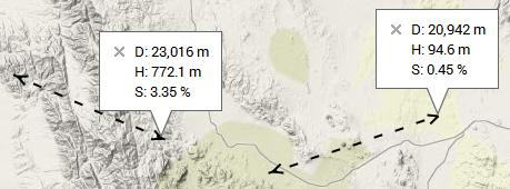
- Distance tool for measuring distance, elevation difference and grade between two points
|
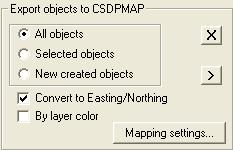
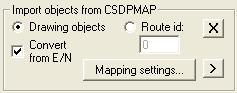
- Exporting objects drawn in CSDPMAP, Google Maps window to CSDPMAP normal environment and importing objects drawn in normal environment to Google Maps window
- Loading of drawn objects automatically whenever CSDPMAP, Google Maps window is opened
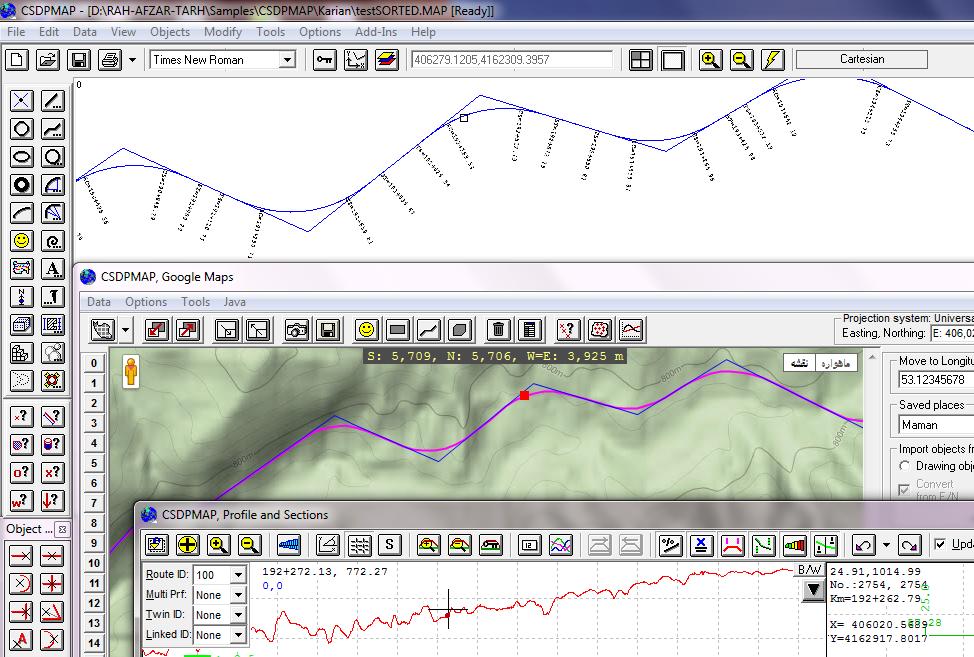
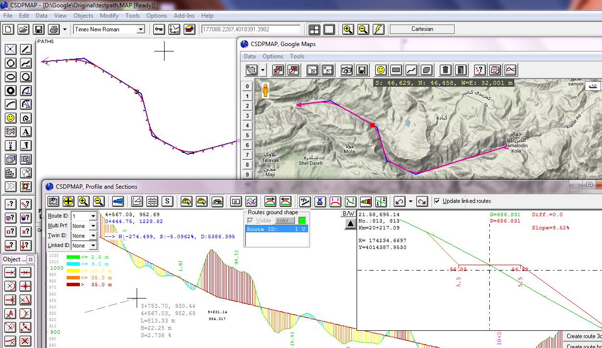
- Importing alignment and geometry of routes from Profiler into CSDPMAP, Google Maps window
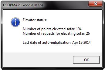
- Possibility to find elevations of individual points with Point elevator tool
- Possibility to find elevations in a map by using Map elevator tool
- Exporting results of Map elevator as a block of texts to CSDPMAP normal environment
|
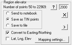
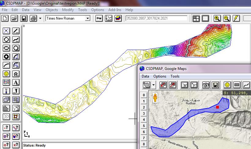
- Possibility to find elevations inside a polygon or a rectangle with Region elevator tool and writing in an external file, or exporting as TIN points to CSDPMAP normal environment for triangulation and creating topography maps
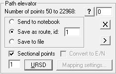
- Extracting profile and sections along a polyline and exporting as a route to Profiler
- Possibility to create images from Google maps and save them as external bitmap or jpeg files in form of one image or tiles of images
|
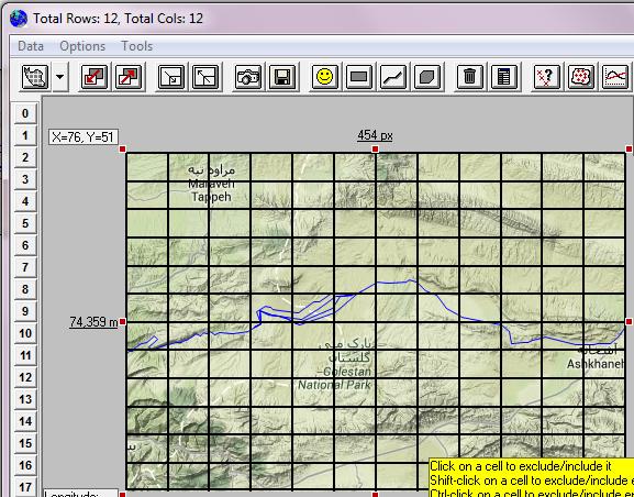
- Possibility to create tiled images by defining number of rows and columns using current zoom
- Possibility to create tiled images by specifying an output zoom, and selecting required cells from the set of resulted cells
|
|
| Back to Top
|
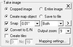
- Possibility to export created images as Map object to CSDPMAP normal environment with 100% correct size and placement
- A summary of objects drawn in CSDPMAP, Google Maps window
|
|
|
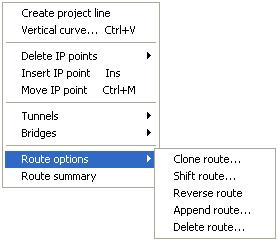
- Possibility to shift a route back and forth
- Possibility to reverse a route
- Possibility to append a route to current route
- Possibility to delete a route
|
|
|
|