Rah AFzar Tarh
Company overview
Products
Contents
Training Videos
Free Stuff
Site Map
Contact us
Support services
Home page
|
- Possibility to interpolate new TIN points when reading points of topography lines in form of polylines from AutoCAD DXF files
- Possibility to convert TIN points coordinates from Cartesian to Longitude/Latitude and vise versa using different projection systems
- A new algorithm for triangulation named as Turbo Algorithm for fast triangulation
- Possibility to draw polylines based on TIN point names in form of TIN point numbers
|
|
- Possibility to create outlines for polyline objects, and possibility to view elevation (z coordinate) of polyline vertices in PEDIT command, and possibility to change level of each vertex directly in PEDIT command
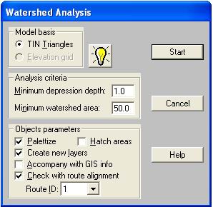
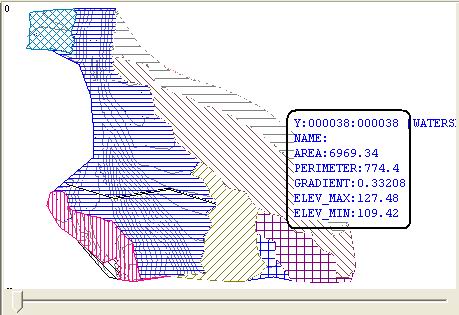
- New tools and functionalities for working in hydrology projects to find watershed zones, and merging watershed zones
- Possibility to analyze and find watershed zones with respect to an existing routes alignment
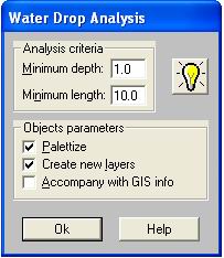
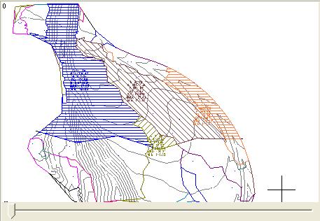
- New tools to find water drop paths in a watershed zone, and merging water drops
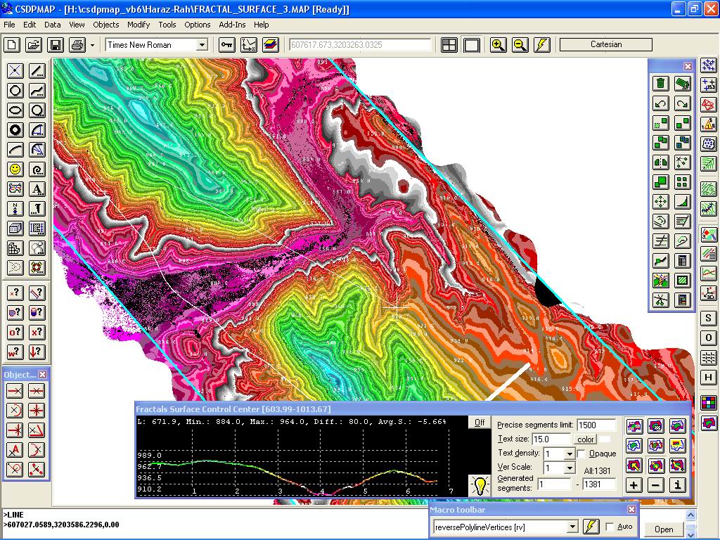
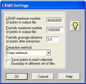
- A new method for making a surface model named as Fractal surface for working with LaserScan points (LIDAR). Using this new method, CSDPMAP can handle 1,000,000,000 laser-scan points
- A new tool for displaying elevations on Fractal surface when moving mouse
|
| Back to Top
|
- A new tool for extracting ground profile along a line or arc when drawing and displaying in simultaneously
- Possibility to etude preliminary designs based on Fractal surface and parameters such as maximum/minimum allowable slope, etc.
- Possibility to extract profile and sections based on Fractal surface, and also using the Fractal surface in grading feature
|
|
|
|
- Possibility to transform a surface model based on TIN points to a Fractal surface model
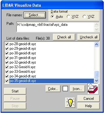
- Possibility to create LIDAR clouds for laser-scan data and assigning GIS data fields to each cloud for visualizing data
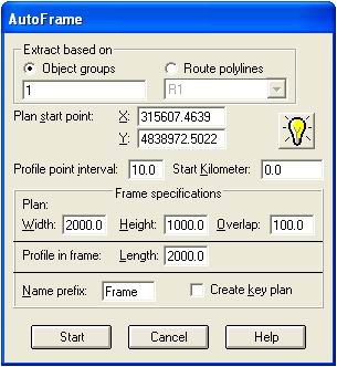
- A new tool for creating frames named as AutoFrame
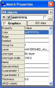
- A new command named as Match properties for matching common properties of selected object with respect to another selected object
|
- Possibility to select all objects in a layer at once, and also possibility to select polyline objects bounded in a specified Region
|
|