Rah AFzar Tarh
Company overview
Products
Contents
Training Videos
Free Stuff
Site Map
Contact us
Support services
Home page
|
- Mapping and design; creating topography maps in surveying projects; with full 3d capabilities;
- CAD Drafting, for creation of engineering and architectural drawings;
- Geographical Information Systems GIS) with full multimedia capabilities;
- Route analysis and design, for roadways, railways, pipelines, and canal projects;
- Compatibility with CSDP for Windows and CSDP-CD for Windows
applications;
- Creating presentations;
- Iconic links to external resources;
- Database compatibility with Microsoft Access® , ORACLE®, and ODBC (Generation 2)
- Support Farsi word processing, with magnificent font shapes libraries.
-
As always we try to achieve almost the best possible results,
CSDPMAP is an application software comparable with each of the following systems:
- SDRMAP®, Microstation® Roadwork,
- AutoCAD®, MicroCAD®
- COGO®, Civilsoft®
- Microsoft PowerPoint®
- A comprehensive 32 bits system, running under Microsoft Windows,
covering most useful features of each of the above mentioned individual
applications, only in one application;
- Getting approach to a new horizon through ideals, by developing a new system;
- 100% compatibility with other CSDP application series; such
as CSDP application (in road design projects) & CSDP-CD application (in Canal design projects)
|
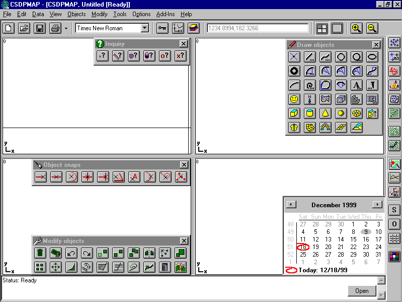
New, Open, Save, Print, Fonts, Lock, UCS, Layers, Coordinates, Viewports, Zoom (In, Out);
Right panel:
TIN points, TIN points tracking, TIN triangles, TIN triangles tracking,
Boundary lines, Break lines, Topography, Plan-profile tracking,
Objects, Profiler, 3d Scene, Snap, Ortho, Grid, Color;
Draw objects panel:
Point, Line (Single, Double, Nuclear), Polyline (Sketch, Hatch,
Ruler), Polygon, Circle, Ellipse, Donut (pie), Circular curve, Two
centered circular curve, Three centered circular curve, Four centered
circular curve, Reverse curves, Parabolic curve, Spiral curve, Cloverleaf
curve, Broken-back curve, Text, Icon, Symbol, Map, Block, Dimensioning,
Cube, Cylinder, Cone, Sphere, Torus, 3D extrude, 3D rotate, 3D loft,
3D sweep, 3D mesh, 3D route;
Modify objects panel:
Erase, Purge, Undo, Redo, Move, Copy, Multiple copy, Mirror, Rotate
Scale, Matrix copy rectangular, Matrix copy polar, Fillet/Chamfer,
Offset, Extend, Trim, Pivot, Polyline edit, Object properties wizard, Explode;
Object snap panel:
End, Middle, Center, Intersection, Perpendicular, Bisect, Insert,
Quadrant, Tangent, Nearest;Inquiry panel: Point ID, Distance, Area,
Grading Volume, Object information, Object coordinates;Four separated
drawing windows (viewports); normal or full screen; has its own
zoom/pan states up to 20 levels each.
Status/Command window at the bottom
|
| Back to Top
|
One of the most useful drawing objects of CSDPMAP is the Map object.
This object enables you to work actually on the maps.
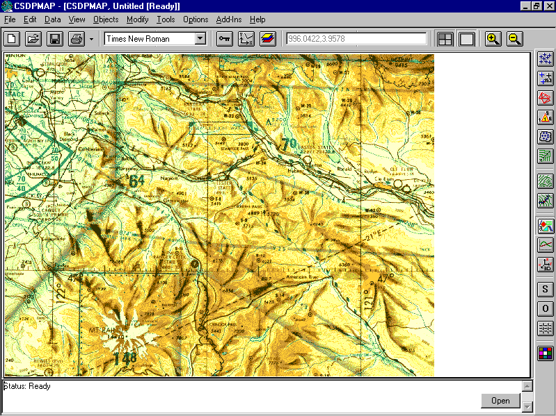
What is a Map object?
- An imported file with one of the formats BMP, WMF, GIF, or JIFF,
which is embedded in the mapping project.
- Scaleable; by defining the width of the Map object. Thus if
you specify, for example, 1000m as the width of your Map object,
all distances on the map, are measured relative to this value.
- Inserted at a specific coordinates; enables you to work with
actual coordinates of points, while working on the Map object.
- Any number of Map objects, can be defined in a project.
- All editing and modifying commands can be applied to Map objects too.
|
| Back to Top
|
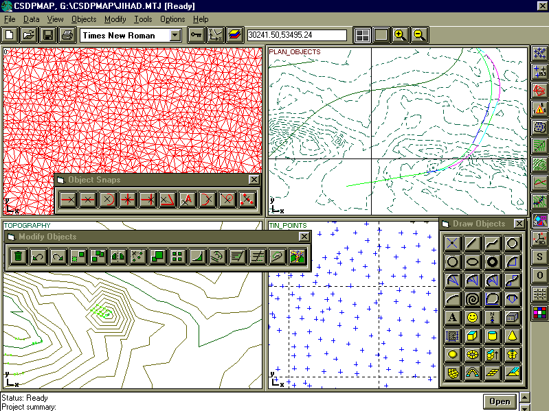
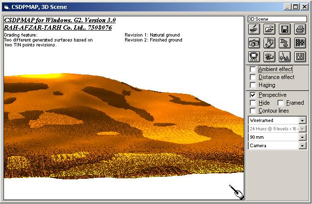
There are six types of separated drawing items. Each viewport is
capable of displaying one or more of the following items: TIN points
(DTM points); TIN triangles (triangulation is done based on the
Triangulated Irregular Network method); Topography map (contour
lines), based on the TIN triangles, boundary lines, and break lines;
Drawing objects; Capability to control the color, linetype, size,
and shape of any drawing items and drawing objects; Capability
to convert TIN points, TIN triangles, contour lines, and longitudinal
profiles (in profiler) to drawing objects; It gives you the capability
to modify the resulting maps, even more.
Capability to read external files, having data of surveying points;
supporting up to 52 various formats as follows :
CSDPMAP format, SDRMAP format, SDRMAP contour format, CGP survey format, CGP xyz format,
Civilsoft format, DIGICAD format, Geotop format, Strada format,
and most important one, AutoCAD DXF Format, and of course more
- Possibility to sort and filter TIN points before and after triangulation;
- In working with TIN points and TIN triangles, you have both graphical
and database editing tools;
- CSDPMAP TIN points database, and TIN triangles database can be accessed easily; CSDPMAP does DDE to Microsoft Excel®;
- TIN points, TIN triangles, boundary lines, and break lines
all can be enabled or disabled. In case of a disabled item, the
item is disregarded during the processes.
Tracking System
- Beside system's databases, there is a tracking system, which enables you
to graphically locate items, and apply the required modifications;
- TIN points tracking, enables you to locate TIN points, giving you
the information about the TIN points, and you can disable or enable
them;
- TIN triangle tracking, enables you to locate triangles, giving
you the possibility to disable or enable them, along with other
modifications like triangles swapping;
- Boundary lines (included or excluded) and break lines can be enabled or disabled;
All changes in triangles, and break lines, reflects the results
in the associated contour lines immediately.
For contour lines, you have the option of defining major and minor increments, and smoothing curve options.
|
| Back to Top
|
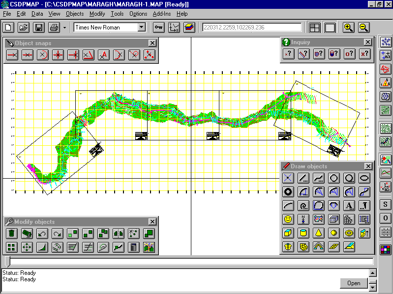
CSDPMAP is an application versatile in the following domains:
- In CAD drafting, for creating engineering and architectural drawings;
- In mapping of small scale projects;
- In mapping of large scale projects; you can use CSDPMAP to read points from aerial photographs by establishing
links to photogrametry apparatus;
- In making presentations;
- In developing a GIS system with multimedia capabilities;
- In Route analysis and design, 100% compatibility with CSDP for Windows, and CSDP-CD for Windows applications.
|
|
|