Rah AFzar Tarh
Company overview
Products
Contents
Training Videos
Free Stuff
Site Map
Contact us
Support services
Home page
|
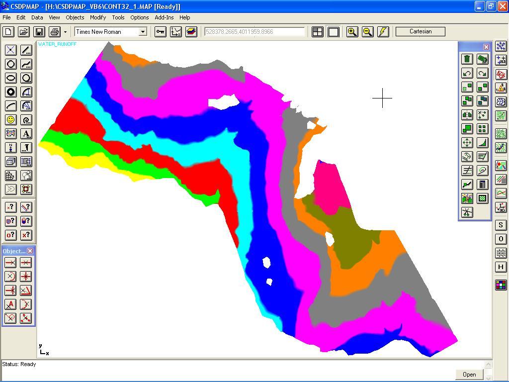
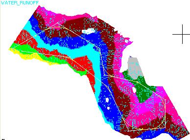
CSDPMAP can be used to create presentations. In this way you can use it to design brochures, catalogues and slides.
However, CSDPMAP combines the graphical requirements with its CAD engine, to enable you to get your job done much quicker and easier.
Importing external image files with various formats, such as BMP, WMF, GIF, JIFF, along with using Windows True-Type fonts, with
text rotation facilities using CAD editing commands, like Rotate, and Matrix copy polar; in this manner CSDPMAP lets you design fantastic presentations.
In addition to the image files which can be imported to a CSDPMAP project, you can use CSDPMAP scaleable icons. Several libraries each having numerous icons are built in to the CSDPMAP application.
In CSDPMAP you can type in Farsi, like a Farsi word processor. Various Farsi fonts, along with special effects on fonts are available (shadowed, aligned, etc.).
To simplify typing in Farsi, various keyboard styles for Farsi characters are supported.
But most important feature of CSDPMAP for typing in Farsi is that, you dont need to have any Arabic or Farsi version of Windows. CSDPMAP Farsi fonts can be used even on English Windows versions like True-Type fonts.
CSDPMAP uses shape technology to implement Farsi fonts.
It is possible to copy the image of the current viewport, and paste it in any other Windows based applications.
|
| Back to Top
|
CSDPMAP has two special drawing objects called as Icon objects, and Symbol objects.
There are hundreds of icons available, each of them can be fixed size or scaleable.
Different libraries for traffic signs, flags, industrial icons, etc. are included.
You can add new icons to existing libraries or even create new libraries and use them in your
projects. In case of Scaleable icons, the size of the icon depends on the overall limits of your drawing window, or print size.
You can use the icons in 3D scene too. Each frame in a film roll may consist of a number of icons.
Symbols are shapes, and CSDPMAP uses shape technology to handle them. CSDPMAP has numerous built-in symbols which
can be used in drawings and projects. You can create new shapes in CSDPMAP. Thus, you can create new Farsi fonts in CSDPMAP.
All editing commands can be used with icons and symbols, like any other objects.
You can copy, move and even mirror an icon or a symbol object.But Icon objects, are not only icons. CSDPMAPs icon objects are
the principal basis of the CSDPMAP GIS system.
The Icon object, which can be inserted at a specific 2D location in your project, has other properties;
|
| Back to Top
|
An Icon object has the following properties :
- Each icon can hold up to 32000 characters long texts in it. Whenever you put an icon in your map, by clicking on the icon,
a box is opened for entering texts. You can use normal text typing operations such as cut, copy, and paste inside the box.
CSDPMAP saves the associated texts of each icon separately.
- Each icon can be linked to 10 different fields from different tables of an external database.
CSDPMAP supports different types of databases, like Microsoft ACCESS, ORACLE, DBASE, etc.
CSDPMAP treats this information as Icons attributes, and show in your drawing.
You have query options on these attributes, but most important is that, with a simple UPDATE command,
CSDPMAP based on new external database files, updates the attributes of the selected icons.
By double clicking on an icon memo text box, CSDPMAP launches the data manager and invokes the corresponding
values of the associated field or record of an icon. As an example, consider that you want to design a bridge in the intersection
of a route and an existing river in your map. By double clicking on the river icon, if exists, CSDPMAP gives you the quantity of
flow in the river.
In the next generations of CSDPMAP, you will find a lot of supplementary databases, filled with relevant information, such as rivers data,
geology of the region etc.
However, you can build your databases and use them in your projects.
- Each icon may have an importance factor from 1 to 1000. You can use the FINDICON command,
specifying the importance factor, to find needed icons.
- You can assign to each icon one audio file and one video file separately. When you click on an icon;
CSDPMAP plays. Instead of assigning an audio file to an icon, you can record your voice containing all necessary
commands and instruction for other staff to complete the job. More than that, you can assign an importance factor
of 100 to an icon. Then when somebody else opens the project, these icons twists graphically to indicate to an important note.
Then he or she can click on it, hear your oral instructions, and
|
| Back to Top
|
- New tools and features that can be used in GIS projects similar to other softwares such as MapInfo, ArcView, and ArcGIS
- Possibility to import MIF, MID file formats
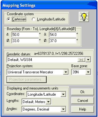
- A new mode named as GIS mode with longitude/latitude compatibility
- Different projection systems along with corresponding parameters, UTM, Lambert, Krovak, Mercator, Cssini-Soldner, Stereographic, etc.
- Possibility to change coordinates from Cartesian to Longitude/Latitude and vise-versa
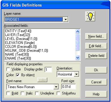
- Possibility to have GIS fields assigned to drawing layers
- Possibility to work with GIS fields data, entering/editing using one of the four tools, importing as MID file, GIS data spreadsheets, Objects Properties Wizard, and in GIS data tracking
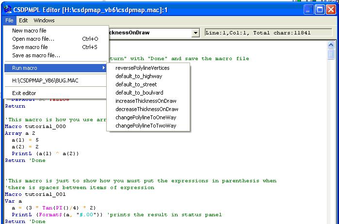
- New commands and statements in CSDPMPL macro language to work with in CSDPMAP GIS system
- A new window named as Macro Editor to load, edit and save macros written in CSDPMPL macro programming language
|
|
|
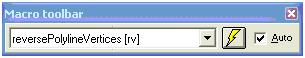
- A new toolbar named as Macro toolbar to execute macros
- Changing displaying mode from Longitude/Latitude to Easting/Northing
- New icons to be consistent with icons used in MapInfo software
|
|
|
|