|
|
|
|
|
|
|
|
- Supporting new Google policies and requirements for taking images from Google maps
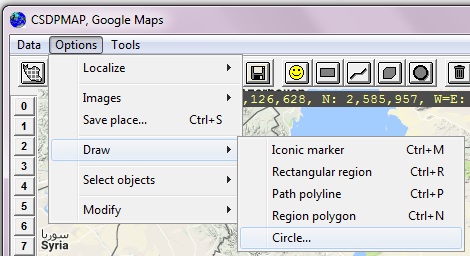
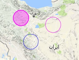
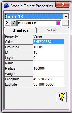
- A new menu option and corresponding tool for drawing solid and empty circles in GoogleMaps
|
|
|
|
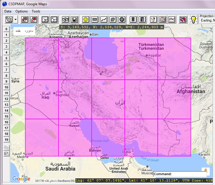
- Possibility to display current JAXA(C) surface coverage in GoogleMaps
|
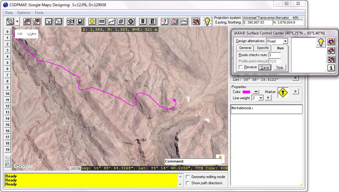
- Possibility to display auto-designed route in GoogleMaps simultaneously
- Possibility to find elevations based on JAXA surface in GoogleMaps environment
|
|
- Possibility to correct extracted elevations based on JAXA surface along a route in GoogleMaps window
- Extracting and displaying ground profile along a path drawn using Path-Polylines in GoogleMaps window in real time
|
|
- Finding different places on maps using Google search engine
|
|
| Back to Top
|
|
|
- Presenting a new surface model named as JAXA(C) surface (http://www.eorc.jaxa.jp/ALOS/en) for modeling natural ground
|
- Possibility to extract profile and sections along a route based on JAXA surface
- Possibility to correct JAXA based extracted elevations along a route in GoogleMaps window using Google elevator service
|

|
- Using JAXA surface for calculating volumetric operations in Grading projects
- Possibility to create topography maps from TIN points extracted in a region based on JAXA surface
|
|
|
- Creating Elevations Grid based on JAXA surface
|
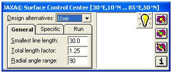
- A new window named JSCC "JAXA Surface Control Center" for working with JAXA surface parameters and tools
- Possibility to find elevations on maps in real time using "JAXA Surface Tracking" tool in CSDPMAP environment
|
- Possibility to extract profile simultaneously when drawing lines, polylines and arcs based on JAXA surface using "JAXA Surface Extratcing" tool
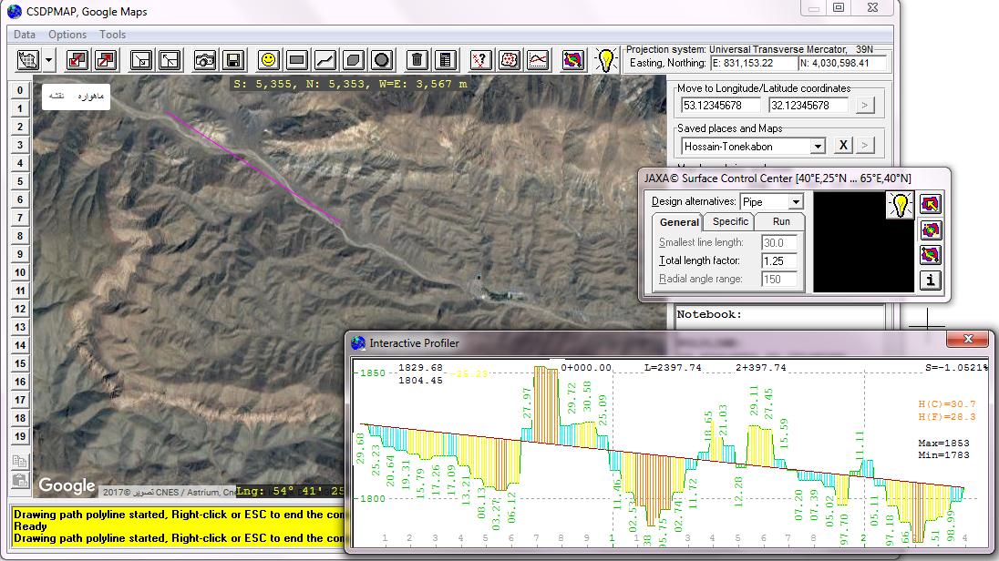
- Auto-designing a route based on JAXA surface using "JAXA Surface Designing" tool
|
| Back to Top
|
|
Other Important Features Added in Release 13.5
|
- Possibility to import data of project files created in CSDP/CSDP+/CSDP-Pro applications and converting them to a route in CSDPMAP having a specific Route-ID
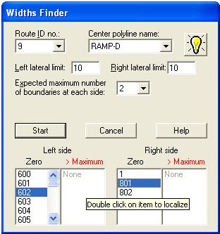
- New control tools when using "Widths Finder" option in interchange design projects
|
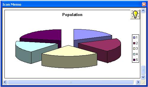
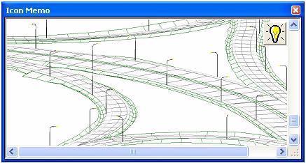
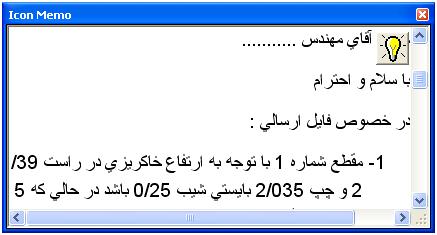
- Possibility to store graphics, formatted text etc. in Memo property of an Icon object
- Possibility to adjust and resize Icon's Memo box for each Icon object separately
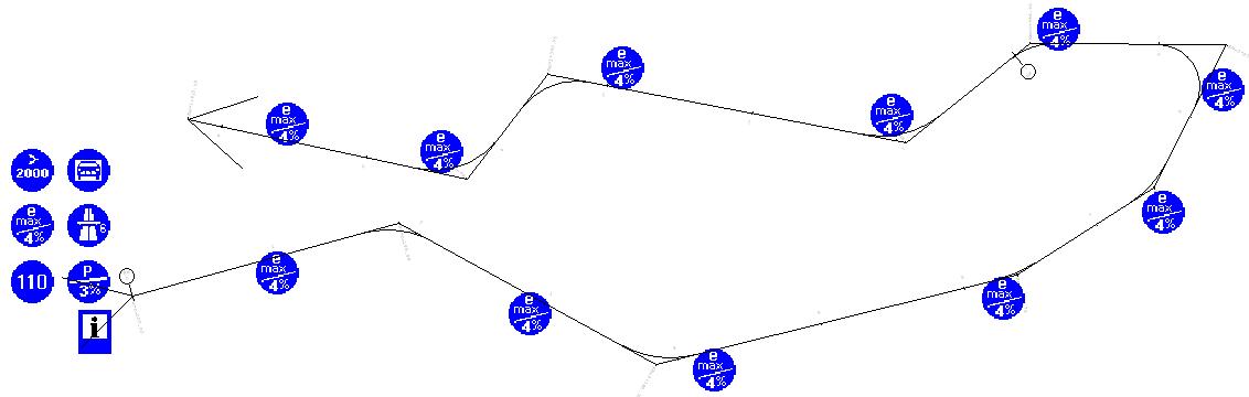
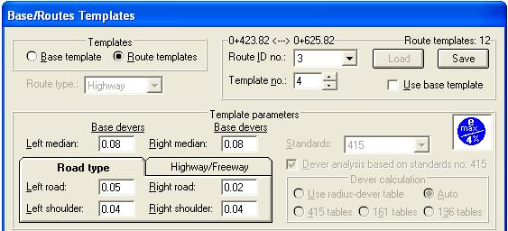
- Presenting radius-dever tables of standards 196, 161, 415 for calculating section devers
|

|
- Possibility to define different "Base Templates" along a route using design standards icons, therefore having different base devers along a route
|
|
|
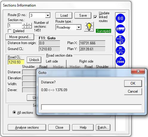
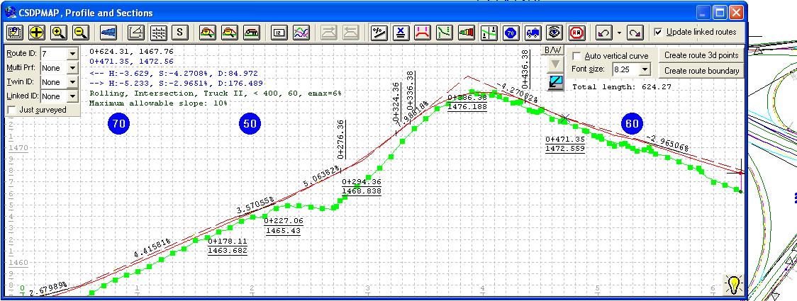
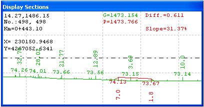
- Possibility to jump to a cross section at a specific kilometer
- A new window for displaying cross sections instead of displaying sections at top-right corner of the Profiler window
|
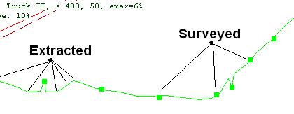
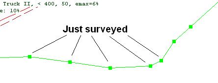
- Possibility to display longitudinal profile of surveyed sections only in Profiler
|
|
- Possibility to delete cross sections in "Cross Sections Information" dialog box

|
|
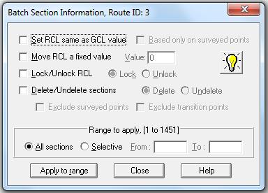
- A new dialog box named "Batch Section Information" for changing RCL, locking/unlocking sections, etc.
|
| Back to Top
|
|
|
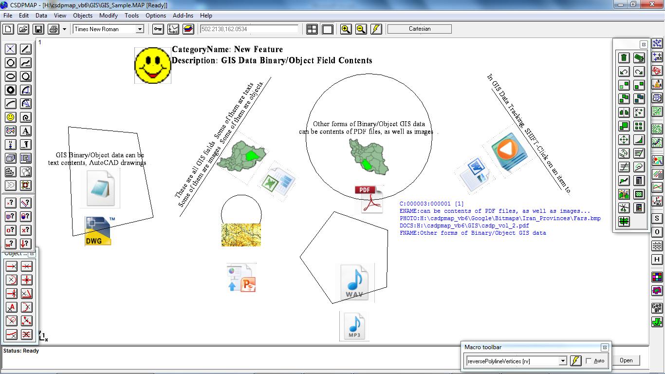
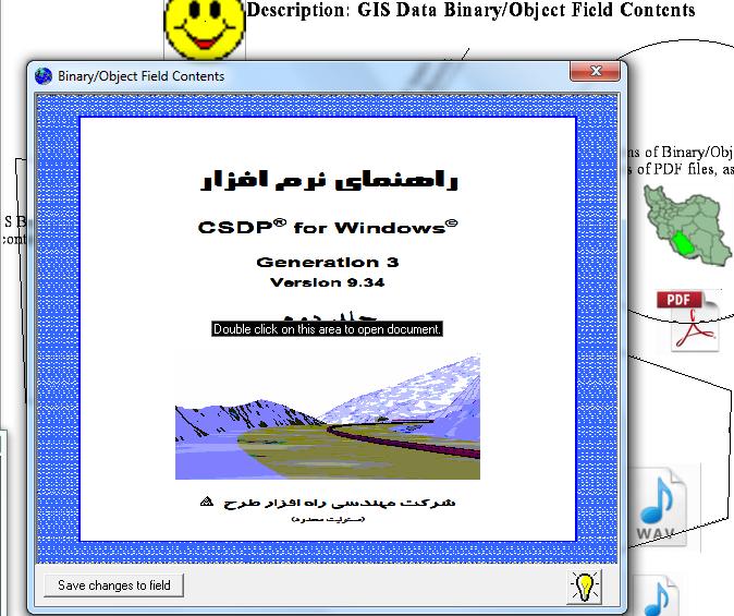
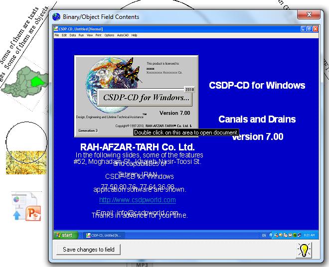
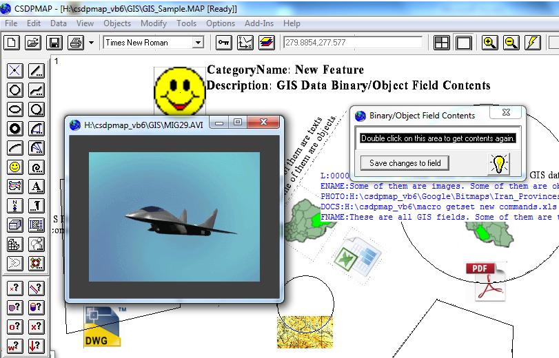
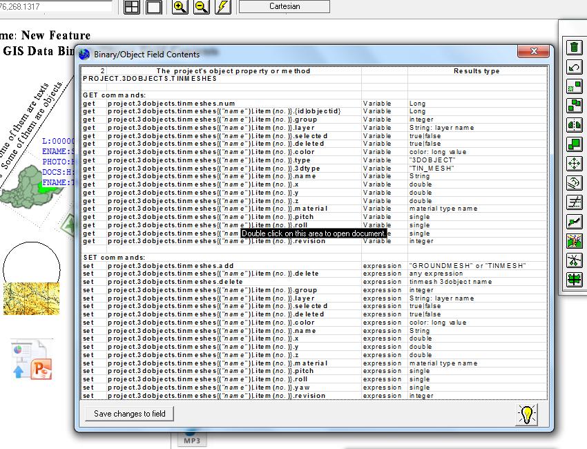
- A new binary field for storing Binary/Object data
|
- Possibility to store different graphics formats in Binary fields and displaying the contents as an image
|
|
- Possibility to store files created in Microsoft Word, Excel, PowerPoint, Access, along with PDF files, AutoCAD drawings and other multimedia files (audios and videos) as object data in a Binary field
- Possibility to retrieve and edit object contents of Binary/Object fields using "GIS Data Tracking" and "Object Embedding" features
|
|