- Cut and fill volumes for sections along tunnel or bridge zones are calculated as zero automatically
- Possibility to draw and sketch longitudinal profile of minimum and maximum ground elevations of every section
- Possibility to shift a project entirely along with all its items for a specified negative or positive distance, and also possibility
to reversing a project
- A new method is added for calculation of constructed sections cut and fill values known as Mixed method
- A new feature is added for defining a second ground shape for every section, and possibility to calculate cut and fill values with
respecting to the two natural ground shapes
- Possibility to read ground section points coordinates from Microsoft Excel files
- Some new criteria are added for pipe line analysis in Pipe line projects e.g. maximum depth of pipe channel
- Possibility to define up to four pipe channels in Pipe line projects at every section and calculation of cut values respecting to channels
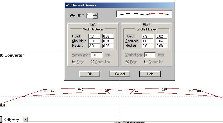
- A new road cross section template is added known as X-Highway
- Number of horizontal arcs increased to 200
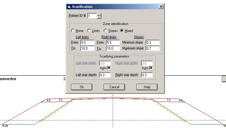
- Some new features are added with regarding to scarification in cross sections in renewing projects, calculation of scarified
points and cut area and length values
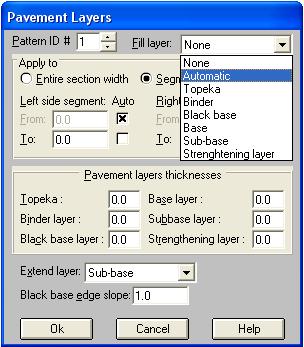
- Possibility to define composite pavements having different pavement layers and thicknesses along the cross section width in
renewing projects
- A new tool is added in Plan mode for designing complete spiral curves having two spirals and a zero length circular curve in the middle
|
| Back to Top
|
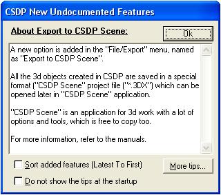
- Possibility to export 3d model of the route to the CSDPScene application software
- Possibility to extend different pavement layers under the shoulder band as Extend layer
- Possibility to have negative values when defining limits for scarification used in embankment condition
- A new option named as Automatic as Fill layer in pavement dialog box, and also check boxes named as Auto for specifying limits of segmented pavement
- A new button named as Adjust proration to check and if required adjust proration lengths of horizontal arcs to avoid interference
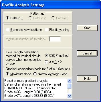
- Possibility to analysis gradient percentages of a route in profile analysis by two methods
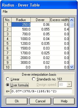
- Possibility to interpolate dever values of horizontal arcs not specified explicitly in Radius-Dever table dialog box
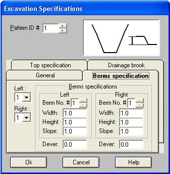
- Possibility to have dever (lateral slope) for berms (stairs) in excavation
- A new format for reading ground section points from Microsoft Excel files
- A new help dialog box as a Tool-tip to display new undocumented features added in new versions of CSDP
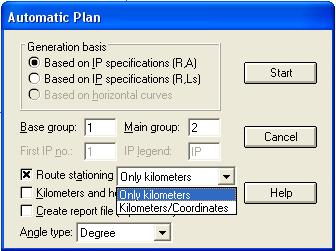
- Possibility to create x, y text information in Automatic plan for starting/ending points of arcs, spirals, etc. as well as the kilometers of these points in plan mode
- Possibility to have profile at edges instead of center line along with corrections to be made for the kilometers
- Possibility to print project line elevations at edge of the route in printing plan shape
- Possibility to export a data file of xyz points for project line at center and edges having specific codes that can be imported to CSDPMAP application software
- Possibility to specify color and size of points used to show extracted cross sections in Plan mode
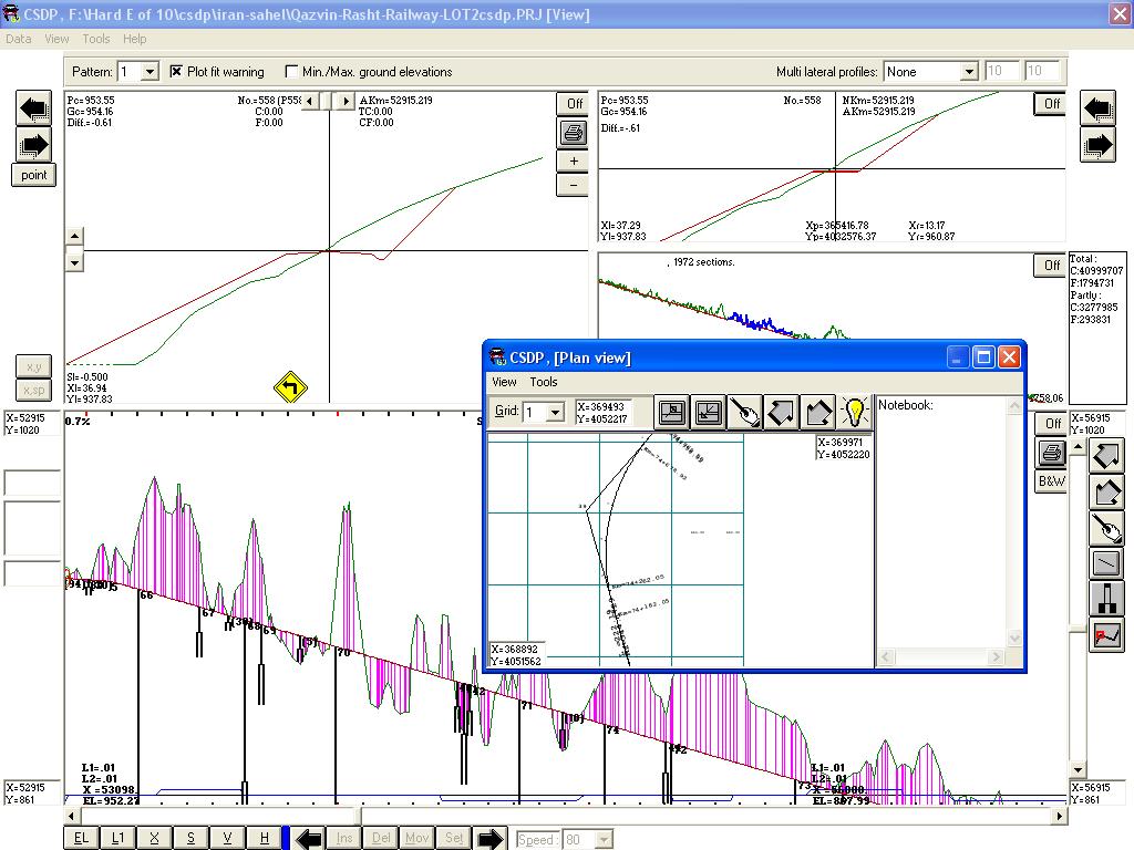
- A new window in Profile and Sections mode that can be used to see routes plan at the same time, named as Plan view window
|
| Back to Top
|
|
|
- New options for zooming in plan mode
- Possibility to have a text file of x, y, z data from elevations grid in plan mode
|
- New editing options such as Cut, Copy, Paste in some dialog boxes dealing with points such as Ground Section Information dialog box
- Possibility to calculate tangent lengths of circular vertical arcs when not specified explicitly by user with two methods of CSDP method and A x R / 2
|
| Back to Top
|
- Possibility to export area and length results from Results mode to Microsoft Excel application software
- Possibility to specify maximum algebraic sum of devers (lateral slopes) of main band and shoulder band with respect to Standards (default of 0.08%)
|
- A new excavation case for berm (stair) at top with a new shape
- new criterion in pipe line analysis named as minimum segment length
|
- Possibility to have pavement shape in form of Offset in all profile types
- Possibility to create and interpolate new cross sections at specific kilometers while analyzing longitudinal profile with Profile analysis option
- A new layout type for profile layout of pipe line projects
|
- Possibility to have longitudinal profile of minimum sectional elevations and maximum sectional elevations along the route in Profile output in right of way
- Mousewheel can be used for zoom and pan operations in Plan mode and Profile and sections mode
- Possibility to have spiral curves in ramps or loops having in angles bigger than 180 degrees
|
| Back to Top |
|

|
- Increasing number of cross section points when extracting from 15 to 48 at each side and possibility to delete those points having almost same slope
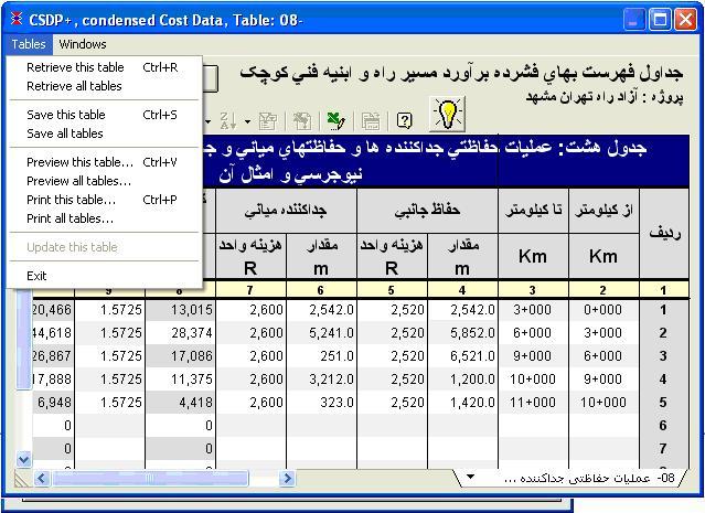
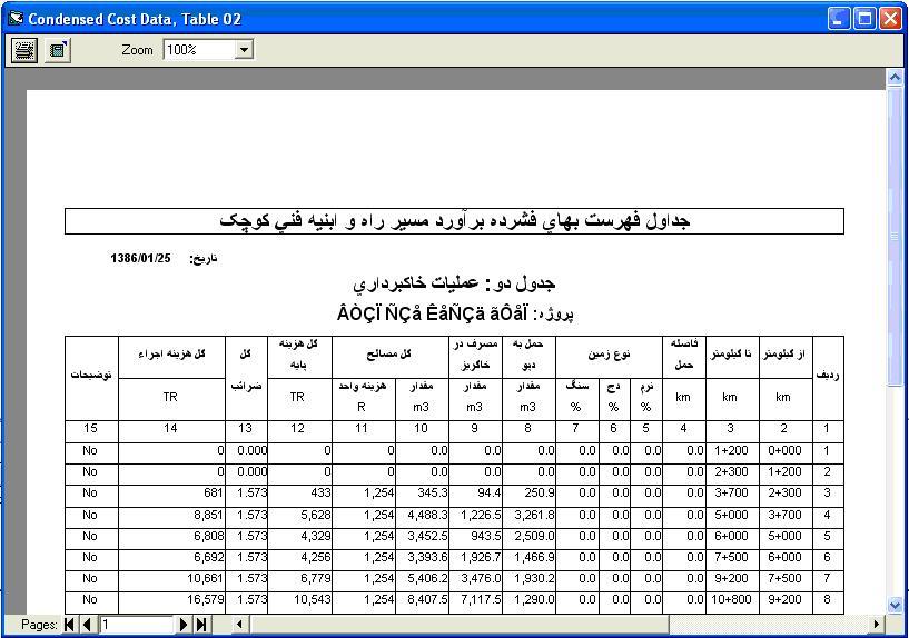
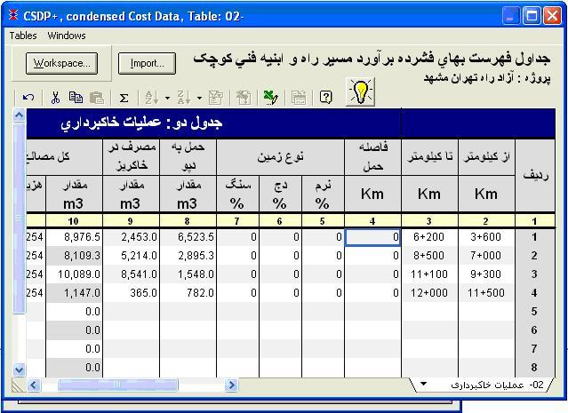
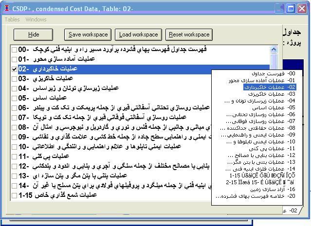
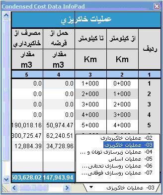
- New options to have condensed cost data tables for area and length items
|