Rah AFzar Tarh
Company overview
Products
Contents
Training Videos
Free Stuff
Site Map
Contact us
Support services
Home page
|
|
The most important feature in CSDP-Pro is the capability to work with highway sectional templates having two different
project levels at left and right side of the routes center line.
In the past, an application software was developed under DOS operating system named as "CSDP
Highway 3.00" for the same purpose. All the capabilities and features of that application along with many more are added in CSDP+ for Windows application.
Extended highway type:
- Two project lines for left and right routes
- Two horizontal alignments for left and right routes
- Increasing number of bands in Extended highway template
- Possibility to analyze left and right cross sections as separated or combined
|
- Constructing combined cross sections based on separated horizontal alignments of left and right routes
- A new template named as Extended highway type
- Increasing number of bands in Extended highway templates
- Possibility to define two longitudinal project lines for left and right routes
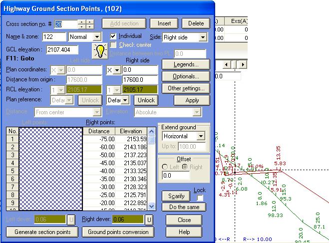
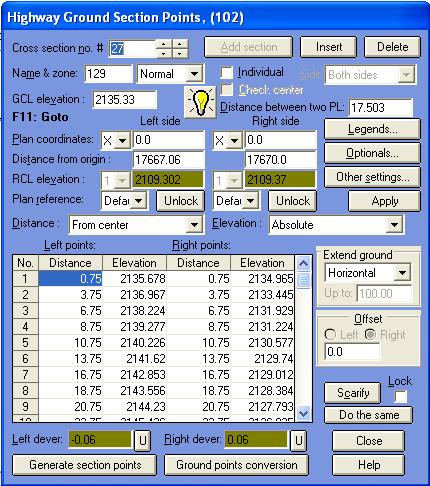
- Possibility to specify project levels at left and right side of a cross section separately
- Possibility to specify distance between two PLs in Extended highway template
- Possibility to analyze left and right cross sections as combined or separated
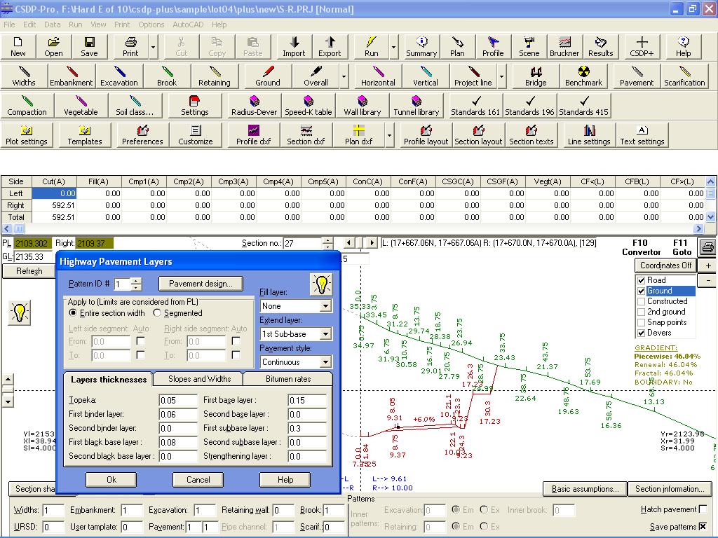
- Increasing number of pavement layers (two binder layers, two black base layers, two base layers, and two sub-base layers) and
calculation area of each layer and length of required tack coats separately
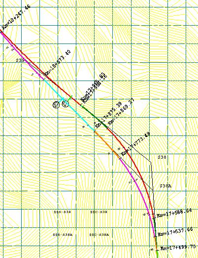
- Possibility to define different kilometers for left and right sides of a cross section, and possibility to specify dominating side of
cross sections kilometers for volumetric calculations (left, right or both sides)
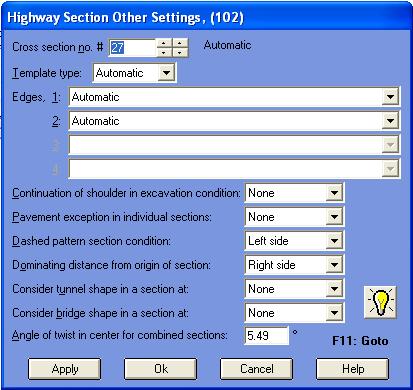
- Possibility to specify side of tunnel or bridge (left,right or both sides) in Extended highway template
- Possibility to change any parameters of a cross section template as Optionals
- Possibility to import old input files of DOS version of CSDP-Highway application and changing to CSDP+ for Windows format
- Possibility to create 3d model of route having Extended highway sectional template
|
| Back to Top
|
- Adding a toolbar to Normal mode to access dialog boxes easily
- Writing coordinates of points of ground, road, constructed, second ground at every cross section in Normal
mode or Profile and sections mode
- Displaying calculated area and length items for every cross section in Normal mode
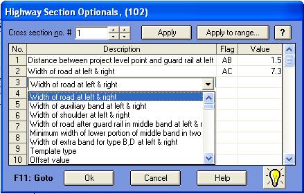
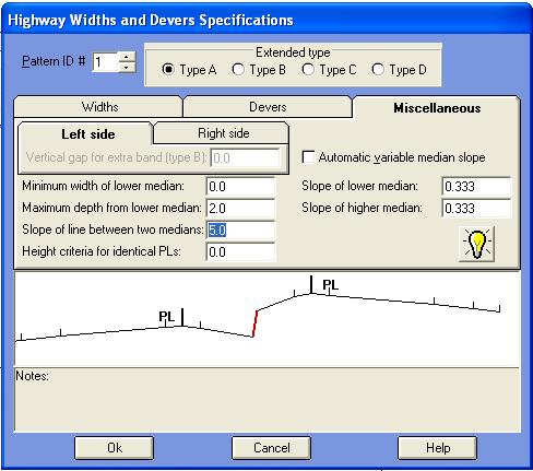
- Possibility to define widths and devers of cross section template as Optionals
- Possibility to display and print tunnel shape in cross sections and longitudinal profile and also changing cross section zones accordingly
- Possibility to permanent saving of changed values of area and length items in Results mode, even after reanalysis of cross sections
- Possibility to export created 3d model to CSDP-Scene application
- Possibility to extend binder, black base, and base layers beneath the shoulder
- and ...............................
|
| Back to Top
|
- A new window is added as Tooltip that can be used to find newly added features of CSDP-Pro
- Possibility to interpolate dever for radiuses not existed in Radius-Dever table
- Possibility to define steps for Case B in embankment condition
- Possibility to specify dever for berms (stairs) in excavation condition
- Possibility to specify gabion instead of retaining wall in cross section
- Possibility to extend different layers of pavement underneath shoulder band
- Possibility to calculate area and volume of vegetable soil (organic soil) for sections in excavation condition
- Possibility to import total calculated volumes and areas quantities from other project files
- Possibility to specify Optionals for cross sections separately
- Possibility to import constructed data from Microsoft Excel files, along with interpolating to match constructed data to existing cross sections
- Possibility to adjust proration lengths of horizontal curves automatically to avoid interference of curves
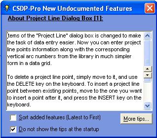
- A new dialog box with more options to specify project line points
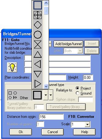
- Possibility to define profile special symbolic legends to be displayed and printed in the longitudinal profile in Bridges dialog box
- Possibility to specify reference points for bench marks
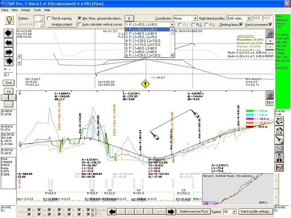
- Possibility to analyze gradients of the route in profile analysis with two methods
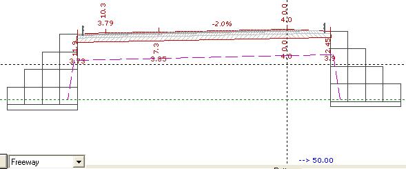
- New displaying items in view profile and sections mode to display the bridges, tunnels, start and ending kilometers of vertical arcs
same as the printed layout
- Possibility to save manual changes of area and length
items permanently in such a way that it persists even after reanalysis of the project
- New tools for zooming in Plan mode
- New properties for text objects in Plan mode
- Possibility to consider special kilometers of the route when working with Automatic plan option in plan mode
- Possibility to calculate cross section kilometers based on the x, y coordinates of the cross section and the routes plan
- Possibility to have profile layout in printing same as the section layout to have multiple profile sheets in one AutoCAD layer
- Possibility to specify a second scale for printing cross section shapes, and also real scale option
- Possibility to print (AutoCAD DXF file) cross sections in real scales and real coordinates
- Possibility to combine cross sections of different projects laterally (side by side, and one to one)
- Possibility to export 3d model of the route to the CSDPScene application software
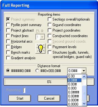
- A new feature named as Full reporting to have a comprehensive and detailed reporting for different items in a project
- Possibility to export area and length results from Results mode to Microsoft Excel application software
- Possibility to control the speed of moving between cross sections in Profile and sections mode
- Possibility to have active and inactive project line points in designing of project line. Only active points are assumed.
- Possibility to transfer sectional points in one cross section from one group to another, means basic ground to second ground, project
points to constructed, constructed to basic ground, etc.
- New tools for zoom and pan operations in Profile and Sections mode.
|
|