Rah AFzar Tarh
Company overview
Products
Contents
Training Videos
Free Stuff
Site Map
Contact us
Support services
Home page
|
- A new algorithm is added to consider clause A of cost-estimate book for canal and drainage projects
- Possibility to define overbuilt parameter
- Possibility to define trimming thickness based on the bottom width of canal
- Possibility to define negative slope and thickness values for pavement parameters to gain required pavement shapes
- Possibility to calculate regulated surface length and area values in embankment condition for compacted zone separately
- Possibility to use distance from origin (kilometer) of sections in Overall Section Information dialog box, in addition to of cross
section numbers for defining a range
- Possibility to define a height condition for changing embankment slopes at each side
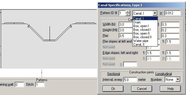
- Possibility to define filters for canals with different thickness in wall and base of canal
- Possibility to define keys in filters and drainage pipe in each key and calculation of filter material area in each section
- Possibility to define filter placement in canals manually or automatically
- Possibility to sketch hydraulic line level and service road level in longitudinal profile shape
- Possibility to calculate gutter areas and volumes for every section
- Using Microsoft Jet Engine Technology to speed up the process of extracting profile and cross section points data from topography files
|
| Back to Top |
- Possibility to sort and filter points data in Plan mode
- Possibility to round distances from origin (kilometers) of sections in extracting cross sections from topography files
- Possibility to define same slope and maximum partial distance criteria in extracting profile and cross sections from topography files
- Possibility to create a report from the horizontal alignment of the route in extracting profile and cross sections
- Limitation of number rows and columns of elevations grid no longer exists
- Possibility to draw routes plan in Plan mode automatically based on an Ascii file containing IP specifications and curve parameters
- Possibility to draw routes plan in Plan mode automatically based on horizontal curves data
- Possibility to read AutoCAD entities of the type Line, Circle and Arc and Text entities
- Possibility to read data files of TotalStation surveying cameras with FeedBook format
- Possibility to export routes data in a format applicable to FeedBook handhelds
Possibility to export elevations grid data to Microsoft Excel and vise versa
- Possibility to define compaction layers in embankment from top to bottom or bottom to top
- Possibility to define flow quantities in different points of a canal route for hydraulic analysis
- Some new symbolic structures added to be placed in longitudinal profile layout such as Duck bill
- Possibility to read topography polylines data and text data from AutoCAD, and converting it to xyz point coordinates
- Possibility to insert or delete ground section points in the middle of the points in Ground Section Points dialog box
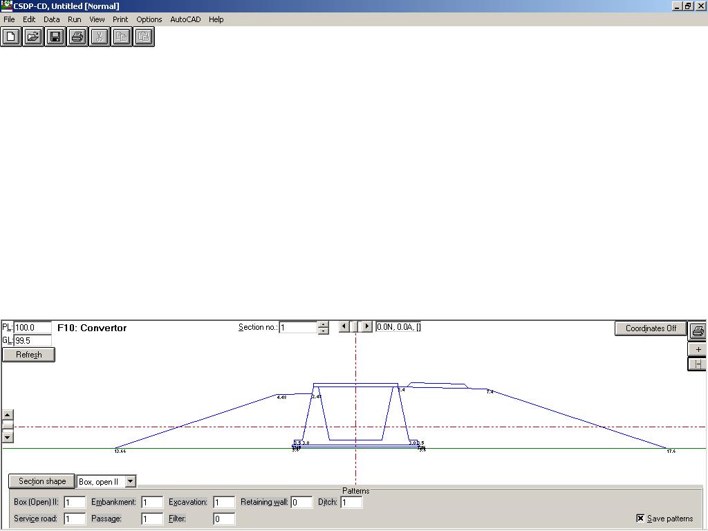
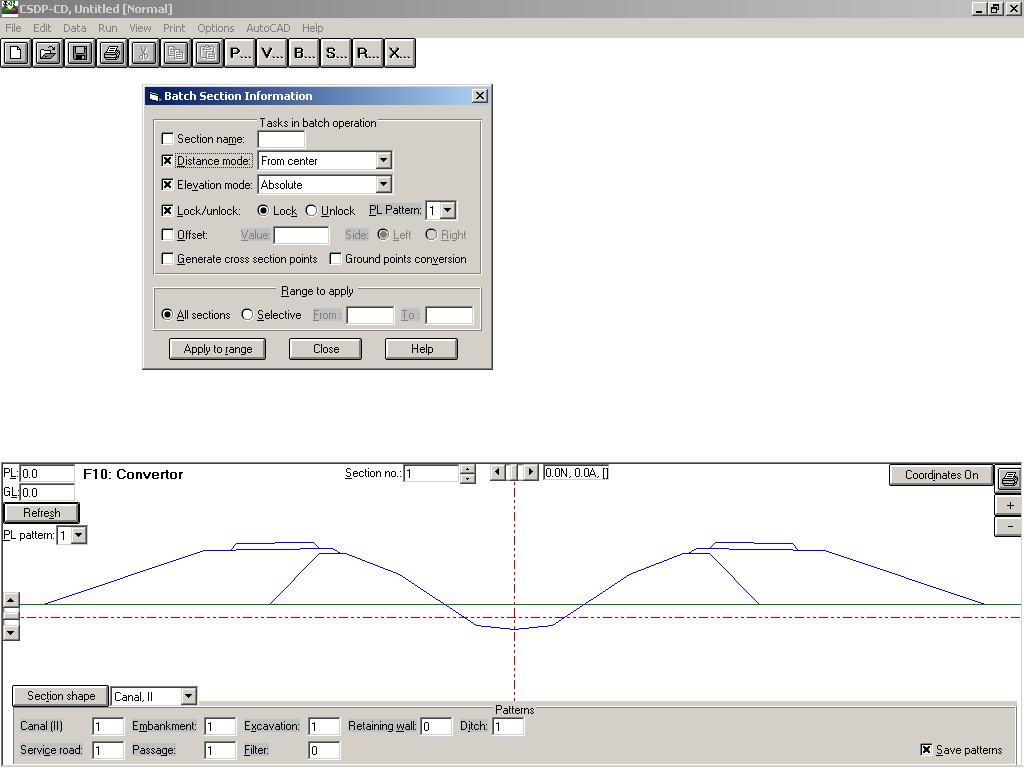
- A new tool known Convertor is added to convert nominal and actual distances from origin (kilometer) and vise versa
- Possibility to insert or delete horizontal arcs in the middle of the arcs in Horizontal Arcs dialog box
- Possibility to adjust and filter xyz points while sorting
- Possibility to define hectometers distance apart in Making plan dxf for sketching routes plan shape
- Possibility to sketch symbolic icons of structures in routes plan layout
- Possibility to change text sizes in Plan mode with a new command
- Possibility to define sheet length for sketching longitudinal profile layout
- Possibility to define a separate line of project having vertical curves for service road
- Possibility to define circular and parabolic vertical curves
- Possibility to include embankment and excavation lines (boundaries) in Making plan dxf for sketching routes plan shape
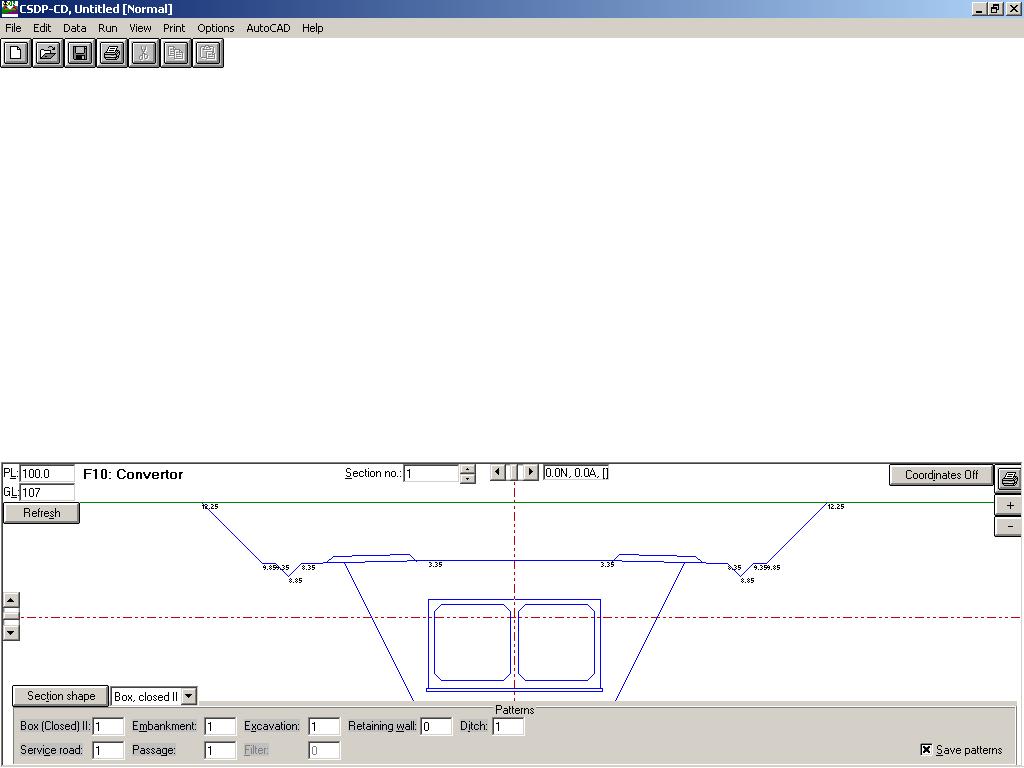
- A new template for open boxes is added
- A new template for closed boxes is added
- A new template for pipe line is added
|
| Back to Top |
- Possibility to design serpentine curves
- Possibility to change sections data in batch form
- Possibility to convert nominal kilometers to actual kilometers and vise versa, and possibility to reverse a project
- Zoom and Pan facilities in plan mode are added
- Possibility to select text objects in plan mode based on the sizes
- Possibility to name groups in plan mode, which can be assumed as counterparts of layers in AutoCAD (while importing or exporting the
group names are converted to layer names and vise versa)
- Possibility to define section layout for sketching purposes such as sheet length and width, clearance etc.
- A new template for canal types is added known as earth canals
- Possibility to have multi-type project (canal, box etc.)
- A new method for soil classification is added known as Level method, and possibility to combine Percentage method with Level and Depth methods
- A new type for soil classification is added known as rock cut-off with burning materials
- A new object known as Frame is added in plan mode for making plan-profile sketches
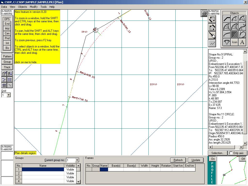
- Possibility to define frames manually based on the insertion point, width and length of the frame, and the escapement value
- Possibility to use AutoFrame tool for creation of Frames based on the specified route
- Possibility to convert line objects in plan mode to Frame objects
- Possibility to create x-y grid lines in every frame automatically
- Possibility to sketch plan-profile layouts with a new added option in menu (Making plan-profile dxf)
|
|