Rah AFzar Tarh
Company overview
Products
Contents
Training Videos
Free Stuff
Site Map
Contact us
Support services
Home page
|
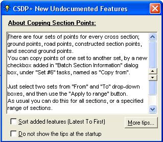
- A new window is added as Tooltip that can be used to find newly added features of CSDP+
- Possibility to interpolate dever for radiuses not existed in Radius-Dever table
- Possibility to define steps for Case B in embankment condition
- Possibility to specify dever for berms (stairs) in excavation condition
- Possibility to specify gabion instead of retaining wall in cross section
- Possibility to extend different layers of pavement underneath shoulder band
- Possibility to calculate area and volume of vegetable soil (organic soil) for sections in excavation condition
- Possibility to import total calculated volumes and areas quantities from other project files
- Possibility to specify Optionals for cross sections separately
- Possibility to import constructed data from Microsoft Excel files, along with interpolating to match constructed data to existing cross sections
- Possibility to adjust proration lengths of horizontal curves automatically to avoid interference of curves
- A new dialog box with more options to specify project line points
|
| Back to Top
|
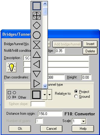
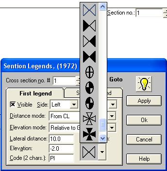
- Possibility to define profile special symbolic legends to be displayed and printed in the longitudinal profile in Bridges dialog box
- Possibility to specify reference points for bench marks
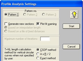
- Possibility to analyze gradients of the route in profile analysis with two methods
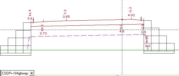
- New displaying items in view profile and sections mode to display the bridges, tunnels, start and ending kilometers of vertical arcs
same as the printed layout
- Possibility to save manual changes of area and length
items permanently in such a way that it persists even after reanalysis of the project
- New tools for zooming in Plan mode
- New properties for text objects in Plan mode
- Possibility to consider special kilometers of the route when working with Automatic plan option in plan mode
- Possibility to calculate cross section kilometers based on the x, y coordinates of the cross section and the routes plan
- Possibility to have profile layout in printing same as the section layout to have multiple profile sheets in one AutoCAD layer
- Possibility to specify a second scale for printing cross section shapes, and also real scale option
- Possibility to print (AutoCAD DXF file) cross sections in real scales and real coordinates
- Possibility to combine cross sections of different projects laterally (side by side, and one to one)
- Possibility to export 3d model of the route to the CSDPScene application software
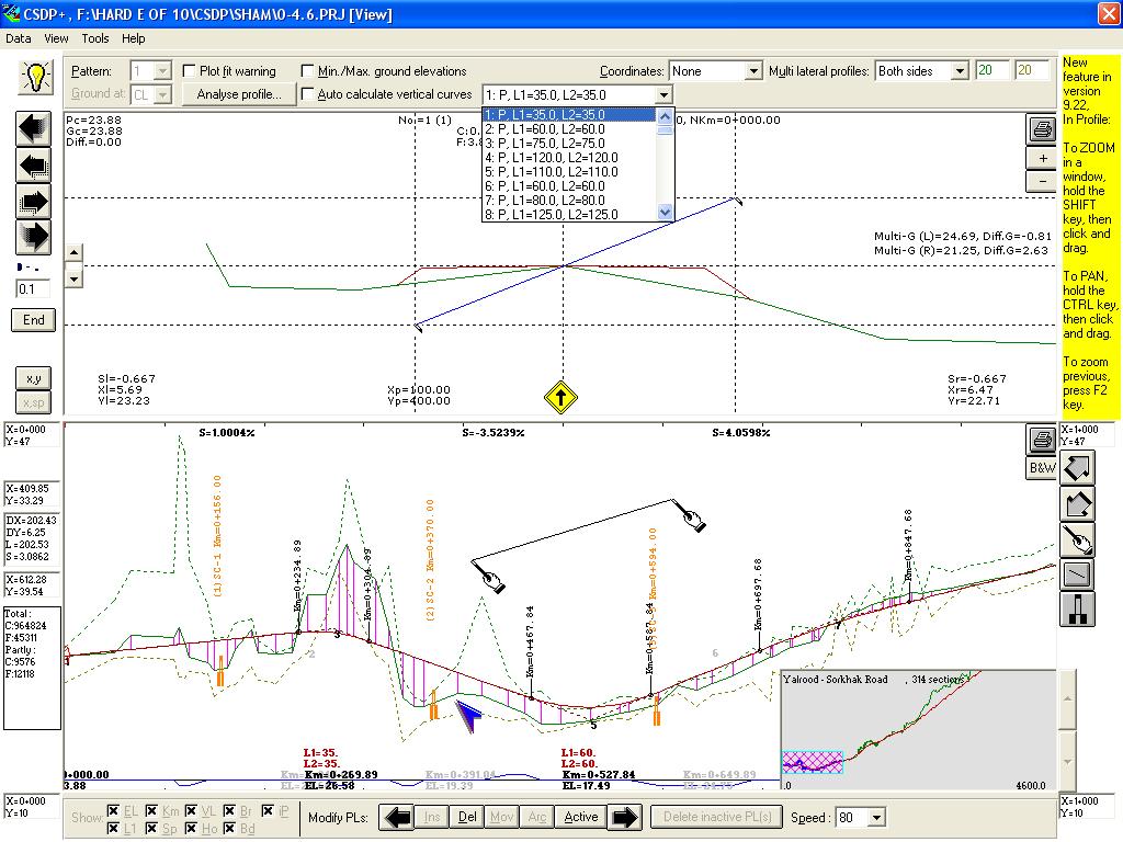
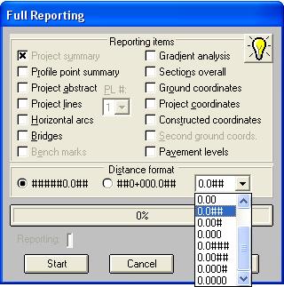
- A new feature named as Full reporting to have a comprehensive and detailed reporting for different items in a project
- Possibility to export area and length results from Results mode to Microsoft Excel application software
- Possibility to control the speed of moving between cross sections in Profile and sections mode
- Possibility to have active and inactive project line points in designing of project line. Only active points are assumed.
- Possibility to transfer sectional points in one cross section from one group to another, means basic ground to second ground, project
points to constructed, constructed to basic ground, etc.
- New tools for zoom and pan operations in Profile and Sections mode.
|
| Back to Top
|
- Possibility to have profile at edges instead of center line along with corrections to be made for the kilometers
- Possibility to print project line elevations at edge of the route in printing plan shape
- Possibility to export a data file of xyz points for project line at center and edges having specific codes that can be imported to CSDPMAP application software
- Possibility to specify color and size of points used to show extracted cross sections in Plan mode
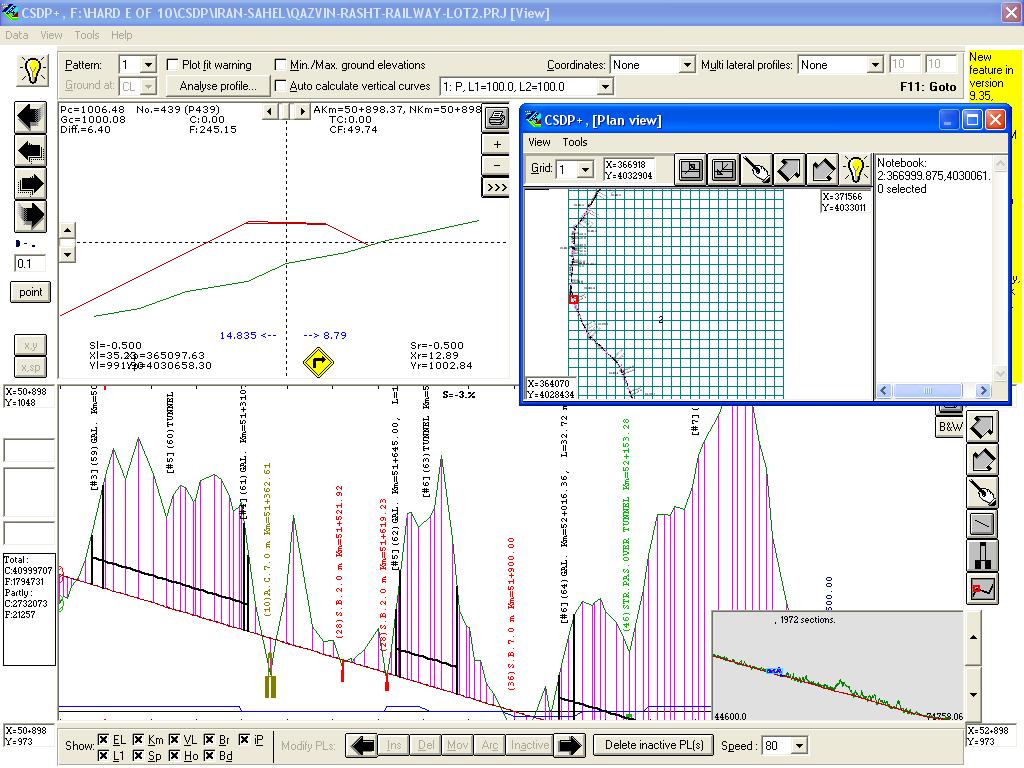
- A new window in Profile and Sections mode that can be used to see routes plan at the same time, named as Plan view window
- A new embankment case named as D for height consideration at center instead of at edge
- Increasing number of radius-dever table from 20 to 40 radiuses
- Possibility to make overall profile region visible or invisible in Profile and Sections mode
- Possibility to specify a Side property for bridges when using Extended highway template type
- A new property for horizontal arcs to categorize arcs to affect only on devers (lateral slopes), only on curves (horizontal alignment) or both (the default)
|
| Back to Top
|
|
- Possibility to specify line thickness and color for special bridges and tunnel in longitudinal profile output
|
|

|
|
- A new tool named as Goto F11 key, in some dialog boxes such as Ground Section Points, Bridges, etc. to move between items based on the specified distance from origin (kilometer of the item)
|
|